Borders, maps and territories
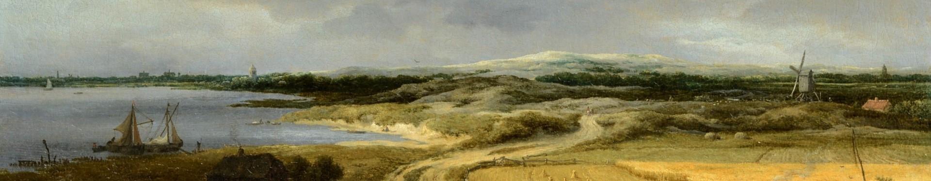
Using many different methods, human beings have always attempted to understand and navigate landscapes. Mapping and surveying are especially useful for those otherwise unfamiliar with a location. Nonetheless, criteria for inclusion on a map may be highly subjective, reflecting the priorities of the surveyor and their society.
Surveying and mapping, placing geographical features in accurate relation to each other, are ways of understanding the landscape, especially for those otherwise unfamiliar with it. Geography and geology, not human beings, determine the natural forms of a landscape, but defining borders, settlements or districts imposes a uniformity. This process may also help to create national and cultural identities. However, this is not by any means always a neutral process. A landscape may be arbitrarily divided, places named by colonisers. Imposing new names and boundaries can be an effective way to erase or appropriate history.

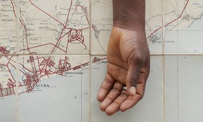
This striking print by Ibrahim Mahama, one of a series, shows a human arm placed over a colonial-era map containing Danish and British placenames. A recurring theme in Mahama's work is to mix old and new, to give old artefacts new and more nuanced meanings. The maps here, repurposed by the artist, indicate how colonial interests once imposed their identities onto Ghana, although it is also suggested that the living man's arm has now metaphorically as well as physically overlaid these, allowing them to recede into the background.
More webpages in the Turner and Changing Visions of Landscape section
More webpages in the Turner and Changing Visions of Landscape section list
-
![]()
Turner and the Thames: Walton Bridges
How Turner and other artists took inspiration from the River Thames and its bridges
See more (Go to Turner and the Thames: Walton Bridges) -
![]()
Redefining and reimagining nature: Romanticism
Romanticism and landscape art
See more (Go to Redefining and reimagining nature: Romanticism) -
![]()
Access, ownership, identity and survival
Issues around access to land and how this effects identity
See more (Go to Access, ownership, identity and survival ) -
![]()
Borders, maps and territories
How humans define and divide the landscape
See more (Go to Borders, maps and territories) -
![]()
Landscape, fragility, permanence and change
How environmental issues affect how we perceive landscapes
See more (Go to Landscape, fragility, permanence and change) -
![]()
Immersion in the landscape: emotional and spiritual wellbeing
The positive impact the natural landscape can have on our wellbeing
See more (Go to Immersion in the landscape: emotional and spiritual wellbeing) -
![]()
New narratives: inclusion and belonging
Feelings of belonging within the natural world
See more (Go to New narratives: inclusion and belonging)


Share this page


